Project description
There are 371 dams in Germany, 56 of which are in Saxony. [1] For many of these, regular structural inspections cannot be carried out on the submerged components. Many bridges and other hydraulic engineering structures whose foundations are located in bodies of water are also rarely inspected below the waterline. A manual inspection in accordance with DIN 1076 is considered state of the art in the field of structural inspection. In the case of underwater components, a complete inspection of the structure is associated with high financial, personnel and logistical costs. An alternative would be to completely drain the body of water, which would result in a loss of supply and would therefore only be carried out in combination with major repairs.
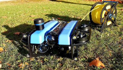
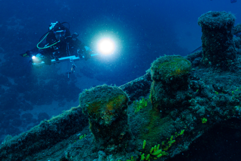
The aim of the project is to develop a cost-effective method for inspecting structures from the water side during ongoing operation in order to facilitate regular, comprehensive inspections. This involves the use of an autonomous underwater vehicle (AUV) that visually records the structures and enables the automated detection of potential damage. In addition, scientific divers check these detected damage sites in order to make a precise assessment. The findings are incorporated into a guideline for systematic structural inspection below the waterline.
Latest news from the project
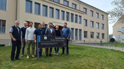
"SUBmarIne" research project launched – kick-off in Karlsruhe
The Submarine research project marks the official launch of another forward-looking initiative within the framework programme ‘Water for the Future’ of the Federal Ministry of Education, Research, Technology and Resources (BMFTR). The aim of the programme is to develop innovative solutions for the sustainable use of water resources and to promote the transfer of knowledge between science, industry and society.
The project management agency Karlsruhe (PTKA) invited guests to Karlsruhe for the official launch. Numerous representatives from research institutions, companies and funding organisations took the opportunity to discuss the planned work and deepen initial collaborations.
The varied programme offered a series of exciting presentations: scientific partners and industry representatives presented their projects and approaches and impressively demonstrated the broad spectrum of research funded under the framework programme – from technological innovations and practical applications to strategic concepts for the sustainable protection of our water resources.
In addition to the technical presentations, the focus was above all on personal exchange. In conversations and discussion rounds, technical synergies were identified, ideas were further developed and new contacts were made. The event thus laid an important foundation for close cooperation between all project partners in the further course of the project.
Submarine makes a significant contribution to the objectives of the ‘Water for the Future’ framework programme. In the coming months and years, the participating partners will work together to develop new approaches to sustainable water resource management – both in research and in practical implementation.
Research in action: SUBmarIne presents results from 2025
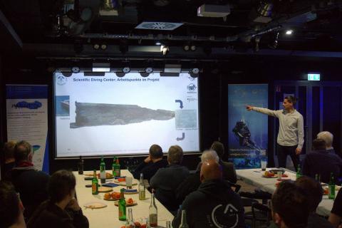
The SUBmarIne research project was presented to a broad specialist audience at the Scientific Diving Centre's 2026 Annual General Meeting. The focus was on the underlying relevance of the problem in the inspection of underwater structures and the project objectives derived from it.
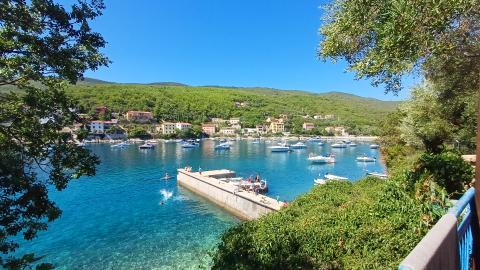
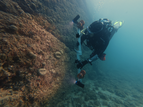
A central theme of the presentation was the presentation of initial research results from 2025. Among other things, the possibilities of photogrammetric 3D modelling of underwater structures and automated damage detection were presented. These methods were intensively tested and further developed during the 2025 excursion to Sveta Marina in Istria (Croatia). The findings obtained there demonstrated the high potential of the methods used for precise and efficient structure inspection.
The results and project progress presented met with great interest and formed the basis for an intensive technical exchange. At the same time, it became clear what potential SUBmarIne has for the further development of modern, automated inspection methods in the field of underwater infrastructure.
Project partners and tasks

Scientific Diving Center Freiberg
- construction of the sensor module with stereo camera system, underwater lighting and line laser
- creation of test specimens with simulated damaged areas for validation, accuracy testing and identification of the system's operational limits
- integration of the sensor module into the dive computer
- construction of the cable routing for the AUV
- analysing the images using photogrammetry
- investigation of a pilot structure
- public relations work

Institute of Computer Science at TU Freiberg
- commissioning the submersible robot
- assembly and commissioning of the land station
- integration of the sensor module into the diving robot
- positioning and path planning of the diving robot
- optimisation of the recording parameters
- analysing the laser projection images
- investigation of a pilot structure
- public relations work

GeoWiD
- recording the actual condition of a reference property
- validation of the different types of utilisation
- investigation on a pilot building
- testing of the final application process
- review / evaluation of sensor detection
- public relations work
Associated partners

Landestalsperrenverwaltung of Saxony
- serves as an interface to the users
- guarantees access to dams
- provides reference and damage data from investigations carried out

DEKRA
- testing centre for structures (above and below water)
- safety and risk assessment in accordance with applicable standards
- assessment of potential hazards and recommendation for repair measures

Milan Geoservices GmbH
- creation of elevation and terrain models
- surveying in water using hydroacoustics and depth sounding
- external expertise for the overall project
- advice on functionality and handling for practical application of the end product


