Image

Inst. Markscheidewesen und Geodäsie / Burkhardt
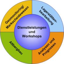
Services in the context of application-oriented research and development
We are happy to partner with you to contribute our experience to solutions for your challenges in these areas.
- Geomonitoring / monitoring (1D, 2D, 3D) concepts, measurements, evaluations / analyses
- Geostatistical data and information analyses, measurement planning, forecasting and simulation
- Mountain kinematic - mining damage analyses and forecasts
- Development of databases and GIS applications
- Special surveys in mining (underground and open-cast mining) and construction (civil engineering and underground construction, tunnelling)
- Trying out and testing new procedures / methods (hardware and software)
- Individual training measures - workshops We offer you and your employees individually tailored training measures in the form of seminars lasting one to several days on the following topics:
- Introduction to surveying technology
- The ETRS89/UTM reference system
- Applied geostatistics in deposit evaluation
- Introduction to the application of international standards for the classification of mineral raw materials
- Introduction to the use of international standards for the classification of mineral raw materials classification of mineral resources
- Introduction to GIS for mine surveying applications
- Terrestrial laser scanning for geomonitoring
In the workshops, the lecturers draw on many years of experience in teaching and practical application. The organisation, duration, focus and teaching methodology are determined in close consultation with you
.