Geoinformatik und Geophysik
Mapping processes in the earth's crust: Computer-aided methods, electromagnetics, seismics, geoinformatics
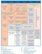
Geoinformatics and geophysics are natural science subjects that represent the mathematical-physical branch of earth sciences. The degree programme combines geoscientifically oriented computer science with geophysics focused on computer simulation. On the Bachelor's degree programme, you will first learn the concepts and working methods of mathematics, physics, computer science and geosciences as well as basic methods of geophysical exploration and geoinformatics data processing. The knowledge is then applied in exercises and practicals.
Geoinformatics
... is the science of systematically recording, analysing and presenting location-based information in order to extract knowledge from it. The focus here is on information in the form of geological and geophysical data. Three-dimensional digital models of geological bodies are constructed as a prerequisite for the application of simulations or statistical methods. Suitable data models, database schemes and software are developed for this purpose. The methods are used in areas such as deposit exploration and mine planning, environmental monitoring and disaster protection as well as in the exploration of renewable energies.
Geophysics
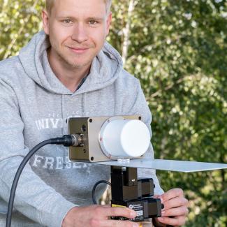
... is the science of the physics of the earth. Geophysicists use geophysical measuring instruments to record fields that are imperceptible to the human senses. These fields contain information about the structure of the earth's interior, which can be reconstructed from the measurements using mathematical-physical modelling. The focus is on near-surface investigation methods, which are of great economic importance, e.g. for the exploration of raw materials, the planning of tunnels and caverns, for solving environmental problems or for locating archaeological sites.
- Faculty
-
Faculty of Geosciences, Geoengineering and Mining (Faculty 3)
- Degree
-
Bachelor of Science (B. Sc.)
- Standard period of study
-
6 Semester
- Part-time possible
-
No
- Start of studies
-
Winter semesterSummer semester
- Admission requirement
-
Abitur or subject-specific higher education entrance qualification or an entrance qualification recognized as equivalent
Language requirement
- Application: with at least B1 level German
- Admission to the degree program: with C1 level German (e.g. DSH-2)
- language courses and DSH exam at TUBAF
- Prep Courses (Studienkolleg)
- Course language
-
German
in the exploration and utilization of renewable energies: e.g. determining the geothermal potential of a subsurface, assisting in the planning of dams and hydroelectric power plants or carrying out safety checks on such structures
in the geotechnical engineering industry: e.g. for preliminary archaeological investigations or to find stable locations for large structures
in institutions or geotechnical engineering companies: e.g. for subsurface investigations, archaeological preliminary investigations or to find stable locations for large structures. e.g. for subsoil investigations, archaeological preliminary investigations or to find stable locations for large structures
in institutions or geotechnical companies: that are active in environmental monitoring and disaster protection, e.g. in checking the stability of dams and hydroelectric power plants. e.g. in checking the stability of dams and dykes under load and vibration
in raw material exploration: e.g. investigating possible oil deposits using geophysical methods or detecting oil traps with underground simulations
in software development: as well as in the sale and support of software products
in research institutions: e.g. in basic research at universities and teaching students
Suitable Master's degree programs
After your Bachelor's degree, you can opt for one of the two consecutive Master's degree programs Geoinformatics or Geophysics.


